Deep Time Materials: Peat
Out on the peat-moss the sky touches the ground
And the birds in the sky look down into the ground for what they want,
and dive
All the low plants together make a very rich colour
And the deep black of the peat
Where it shows
Is like the centre of the earth,
I believefrom Escape, Margaret Tait, 5 Jan 1959
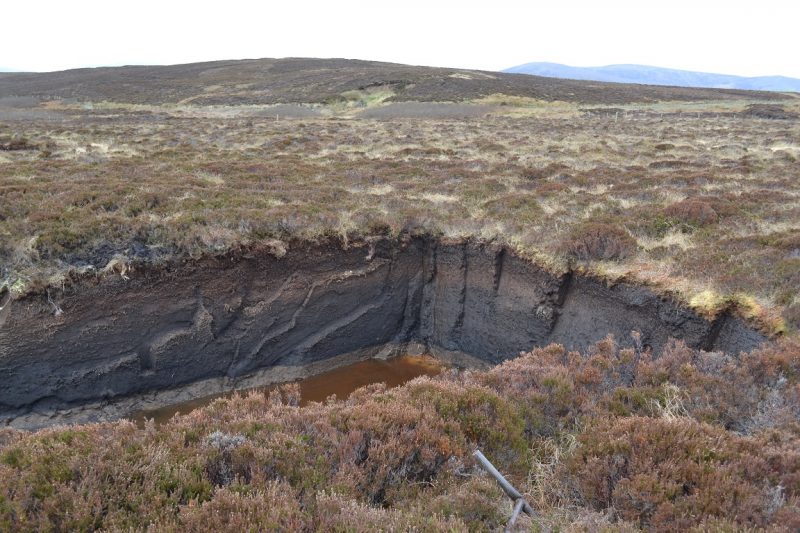
There’s something uncanny about the blackness of the peat. This is what Tait evokes: an almost vertiginous sense of being brought face to face with something deep below the surface, deep below the present.
Partially decomposed matter, peat opens a portal into time. Its life cycle is one of slow pace and long duration. In its waterlogged state, the upper layer is biologically active and open to the air, aiding decomposition. The biomass at this upper layer consists of living organisms including plants and microbes, as well as incompletely decomposed parts of plants and animals. This overlies a lower layer of litter from the decomposition process above. Saturated with water and deoxygenated, hindering decomposition, this lower layer consists of dead matter, or necromass, in conditions conducive to its preservation.
Between living and dying, growing and yet ancient. Our uncertain footing on the soft wet ground threatens to plunge us from the present into something of a different time. Peat is, as the anthropologist Stuart McLean describes it, black, primordial goo. It begs the question: what’s down there?
The characteristics of peatlands make them excellent archives of environmental change. Under the microscope, the atmospherically deposited particles within the peat build a vertical record of transformations in the landscape. Variations in preserved pollen at different depths reveal changes in plant presence; coprophilous fungal spores can reveal animal presence and potentially indicate changing land use (for example, by making it possible to infer the presence of grazing animals in the landscape).
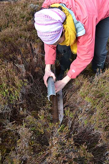
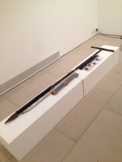
In April 2017, as part of our Festival of Deep Time at the Pier Arts Centre, we took a peat core from Hobbister Moor to place on display, showing how the transitions might be read like a book of time. Peat sequences in this landscape have been well studied and documented by the palaeoecologist Michelle Farrell. Her analysis of cores from Hobbister shows that peat began to accumulate from 5270BC, spreading upslope by 2460BC, and that by the middle Bronze Age heather heathland had become an important component of the landscape. In this time period, the decline of woodland can be traced. Pollen in the peat shows that around 5000BC there would have been nearby woodland including hazel, birch, willow, and alder, with an understorey rich in ferns. The levels of tree pollen then steadily decline over the following 3000 years. Importantly, however, this decline is not uniform, suggesting that woodland loss was localised rather something than happening synchronously across the archipelago, and that human impact and climate both played key roles in this process.
At Hobbister, the transitions revealed by coring into the peat are also revealed by those who dig the peat for fuel. This is the source of the peat used to fire the kilns during the malting process at Highland Park Distillery. In this way, the stratigraphy of environmental conditions over time intersects with a stratigraphy of human usage. Those who dig and use the peat recognise the characteristics of different depths, using cuttings from different layers. The top, or “Foggy” layer, consisting of the youngest peat just below the surface (up to 1800 years old) is rich in heather, imparting the malt used in the whisky with a characteristic flavour. Below that is the “Yurphie”, a darker more compacted layer, said to produce less smoke and more heat. At the bottom the oldest peat (more than 7000 years old), known as the “moss”, is lumpen and coal-like. This is a stratigraphy read not only as a record of time, but in terms of heat and aroma.
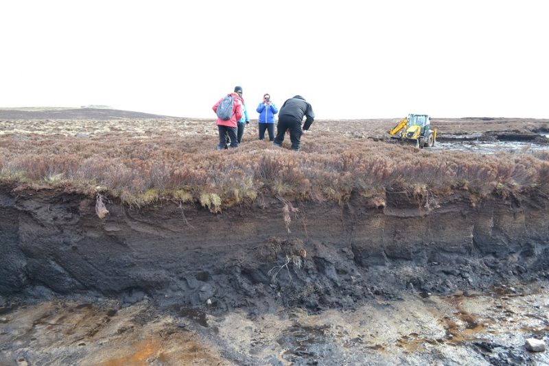
Peat extraction at Hobbister Moor, photo by Carina Fearnley
Recognising that Hobbister is a working environment, we can see that the cores taken by Michelle Farrell are a form of rescue archaeology. As part of the planning permission for peat extraction granted in 2008, it was noted that the machining of peat constituted the loss of a unique environmental record. Paleo-environmental analysis of the peat was specifically identified as an action to be taken to mitigate this loss.
The depletion of peat impacts upon unique habitats, and in so doing converts a carbon sink into a carbon source. The way in which we cut short peat’s life cycle, then, tells us something the human relationship with deep time: the mismatch between human consumption in the short-term and the long term processes that generate the resources we depend on.
At Hobbister Moor, Highland Park works closely with the RSPB and environmental agencies to manage the peatland and to create habitat in places where they have removed the peat, experimenting to establish the best conditions for peat regrowth. Yet the sustainability of peat extraction remains an open question: as the ecologist Kimmo Tolonen has argued, “peat belongs to the renewable resources only in the geological timescale”.
Extraction for use as fuel is only one driver of global peatland loss: worldwide, others include drainage for farmland, afforestation and extraction for as fertiliser. In Orkney a particular factor in recent history has been reclamation of peatlands for grazing livestock. On Rousay, for example, we see the stark edges of moorland cover and visibly eroded peat on the hills. These offer a visible record of 19th and 20th century peat loss due to changing patterns and increased intensity of sheep grazing.

Yet the receding moorland tells a story of social as well as ecological transformation. Rousay was the only part of Orkney subject to the large-scale clearances that completely transformed the geography of Highland Scotland. Today, Rousay’s Westside bears the marks of that clearance, enclosed grazing land dotted with crumbling stonework, the shells of the dwellings of crofters who had to make way. This is improved land: yet it was an improvement that took its toll on the island’s population, and on the peatlands the population lived with.
In 1989, the artist Rachel Harris, who had lived on Rousay since her teenage years, created a work of land art on the Westside to respond to this industrialised landscape. For her ‘Quoy Dyke’ project, she set out to involve the community in building a turf-dyke – a wall built from blocks flayed from the surface of the moor. Such dykes historically had snaked across the landscape, dividing the moorland commons from the cultivated run rigs of the townships. The materiality of the hill dyke stands in stark contrast to the rigid straight lines of stone which characterised the cleared, enclosed landscape with its increased density of livestock.
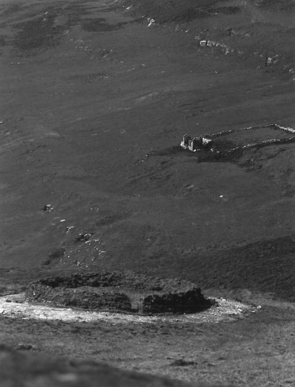
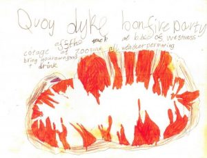
The resulting work, a ring of turf upon the hillside, was then burnt as a bonfire party for the whole island to attend (see below the poster produced by a child at the island school who had helped build the dyke). A site of communal work and communal celebration at the edge of the moor, standing in contrast to the enclosed landscape below, the Quoy Dyke was an attempt at a different kind of reclamation to that which followed the clearance: a reclamation of a contentious landscape by the community.
In this sense the Quoy Dyke looks to the future, asking whether reclaimed land might itself be reclaimed by the habitats and ways of life that once characterised it. Yet at the same time, the work’s continued visibility almost 30 years on (sometimes mistaken for an ancient archaeological remain) shows the fragility of these ecosystems, witness to the deep and lasting marks the human life cycle leaves within the terrain that supports that life.
